I moved to Utah and started hiking 5 summers ago at the age of 65. Ever since then I had dreamed of going up the Pfeifferhorn, but it had always intimidated me. Last week, roughly a month before turning 69 years old, I finally did it!

The 11,329 foot Pfeifferhorn is one of the most iconic peaks in all of Utah. For anyone who considers themselves a peak bagger, this is an absolute must! The Pfeifferhorn hike is extremely challenging because of length elevation gain and some very challenging scrambling. Looking at the Pfeifferhorn lit up by a rainbow last year from Alta made me want to hike it even more!

The Pfeifferhorn is not for the casual hiker. I have seen a lot of people, most much younger than I am, try to hike Mt. Timpanogos. I have seen a lot of people fail. They heard about it from friends, saw posts online and thought anyone can do it. I have seen many people turn back because they didn’t have enough food, water, were wearing bad shoes – or whatever. If you are one of these people, don’t even think about trying the Pfeifferhorn. It isn’t just difficult, it can be dangerous.
My hike to the Pfeifferhorn started just after 4:00 AM. I wanted to get to a certain spot for sunrise – and I did! My goal was to reach the top of the first steep scramble for sunrise. This scramble was just before a fairly level section that lead to the dreaded knife-edge ridge. I got there on time and got some great photos. But let me back up a bit.

My preparation was as it usually is. I loaded up a backpack -plenty of liquid with a lot of electrolytes, homemade jerky for protein and more salt, homemade dried fruit and muffins for quick energy, camera gear, first aid supplies, an extra long sleeve shirt and light jacket for the summit and a few more goodies. I took a little more food and liquid than I thought I needed, but I didn’t overload my backpack. I also wore compression socks and shoes with good support and traction because I always want to take care of my feet.


The hike started on the White Pine/Red Pine Lakes trail. The first 5 miles was mostly in the dark and the sky was filled with stars. As I hiked through the woods I passed the turn to Gloria Falls, a side trip worth taking when the water is flowing well. After another 15 or so minutes I could see the lights of Snowbird up Little Cottonwood Canyon. Not long after this the trail became steeper.

I heard the roar of the creek on my right a number times and soon came to the turn that takes hikers to the Maybird Gulch Trail to the small Maybird Lakes. This is also an awesome hike and when at the tiny lakes you can see the Pfeifferhorn rising to the south.
I stayed on the main trail and continued to Red Pine Lake. Red Pine is gorgeous and is around 4 miles from the trailhead. After walking along the lake, still under the a starry sky on a moonless morning, the trail turned into the woods and once again became steeper. But the first really steep section was another .7 miles ahead.
The first steep section is where the rest of the hike to the Pfeifferhorn got really challenging. I am not as young as I once was and needed to take some short breaks on the way up to this point. On the first steep sections breaks became more frequent, but still fairly short. This section was a little less than ¼ mile in length, but had a steep slope ranging from 40-80%. It was very rocky with loose dirt and I had to use my hands quite a bit.
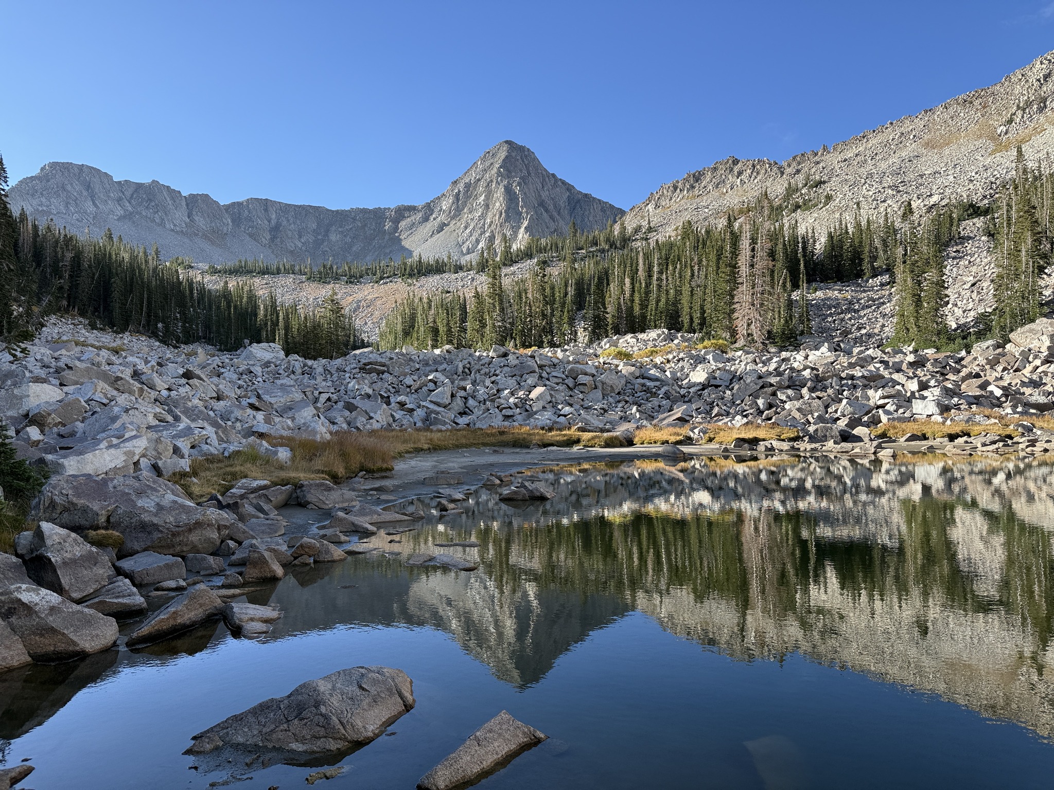
The sun was about to come up when I started up this steep scramble and the scenery was amazing!
At the top of this section the hike got somewhat level for around a little over a third of a mile. The sun was coming up and the views all around were stunning. I could see Red Pine Lake and the Upper Red Pine Lakes below me. The early morning sun started to light up Timpanogos to the south. I could see Utah Lake to the southwest and Mt. Nebo, which I summited 2 weeks earlier, just beyond the lake. And of course, I got my first close-up look at the beast called Pfeifferhorn!


Crossing this section was a treat – the view in the early morning light was incredible! This section also gave me a chance to take in some liquid and calories while hiking at a pretty relaxed pace. I was hiking more slowly to rebuild a little mental energy for what was just ahead.
Then I got the famous knife-edge ridge. This ridge was roughly 100 yards long and was made up of slabs and boulders with steep, dangerous drops on both sides. It was a class 3 scramble and I took my sweet time getting across it.
On any other day I might have done this hike with someone who knew the route and could show me the way. But I decided this was a challenge I wanted to do on my own. Every step was thought out and taken with great care. In several areas I had to stop and backtrack to find a better way. Although three points of contact were required on much of the ridge, there were a couple of place I could get the camera out.


Getting across the ridge was a relief, but it wasn’t actually as difficult as I thought I would be. After having heard so many people talk about how scary and dangerous the ridge was, I found it to be a confidence booster. Now I had to scramble up the final steep section to the summit.
The final push to the Pfeifferhorn summit was short in distance, but it was very steep. There was a lot of loose dirt and once again, every hand and foot placement had to be done with care. I took a lot of short breaks because the effort and altitude had this old hiking dude’s heart rate and breathing going hard!


I was pretty thrilled to reach the summit. I met some young guys who had passed me on the way up and we hung out for around 20-30 minutes. The Pfeifferhorn summit was kind of of a narrow ridge. The drop to the north was almost straight down and the slope to the south was just plain steep. However, there was plenty of room to sit and eat and rehydrate. There was also a good line to walk along just to check everything out.
The view from the summit was amazing! I would see Utah Lake and the cities along it, Timpanogos, Nebo, and other peaks. Lone Peak and the ridge to Bell Canyon were literally less than 3 miles away.


After around 30 minutes on the summit it was time to head back down. This was a time to muster all the concentration and energy I could because the descent would be very hard. Not only did I have two very steep sections and the ridge ahead of me, but It was over 5.5 miles and a 3,800 vertical foot descent back to the trailhead.
When I reached Red Pine Lake I knew the hardest part of the hike was over. Now it was time to reflect on what I had done and just enjoy the easy hike back to the trailhead.
I got back to my car just after noon. The 11.5 mile hike had taken this old guy around 8 hours to complete. This included time on the summit and a good number of breaks. I was very tired, but elated – at almost 69 year old this Old Hiking Dude had finally conquered the mighty Pfeifferhorn!
By the way, I post many more videos so please follow me on Instagram:
@samtheoldhikingdude
https://www.instagram.com/samtheoldhikingdude
And TikTok:
@oldhikingdude
https://www.tiktok.com/@oldhikingdude
Leave a Reply