The trail to Amethyst Lake starts at Christmas Meadows, off the Mirror Lake Highway, aka State Route 150.
Amythest Lake is in the Uinta Mountain Range. The Uintas are close in the northeast part of Utah almost to the Wyoming border.
The trail to Amethyst Lake is about a two hour drive from Salt Lake City and a little over 35 miles south of Evanston, Wyoming. As stated earlier, it starts at the Christmas Meadows Campground, located high up in the Uinta-Wasatch-Cache National Forest. Click for a map. The first couple of miles of the trail is fairly gentle with some elevation gain, then it gets a bit steep. After a steep section that goes perhaps half a mile or so it gets a bit more gentle, but continues uphill all the way to the lake.
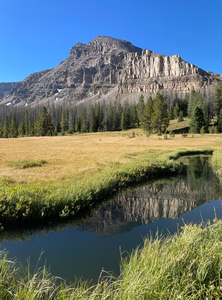
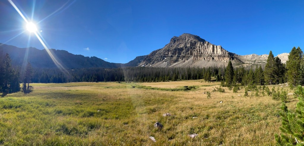
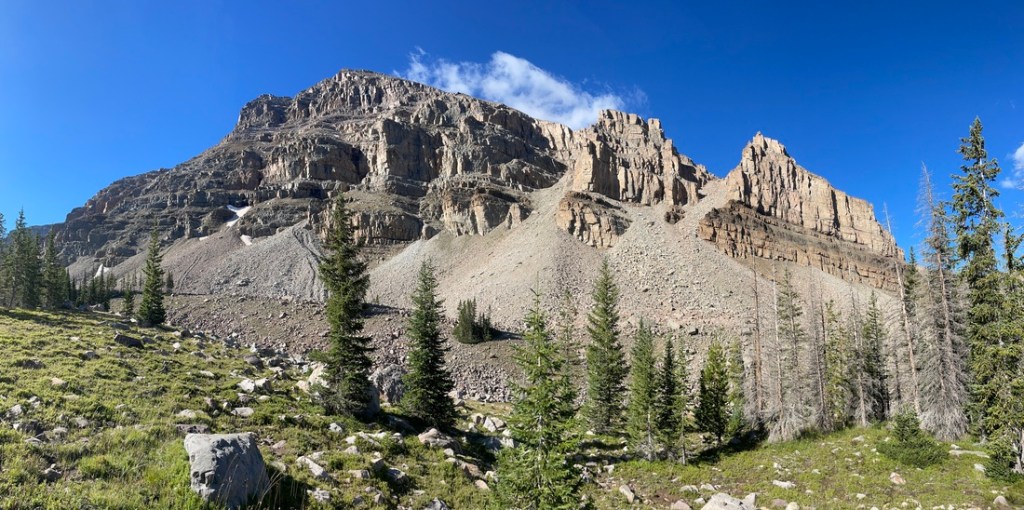
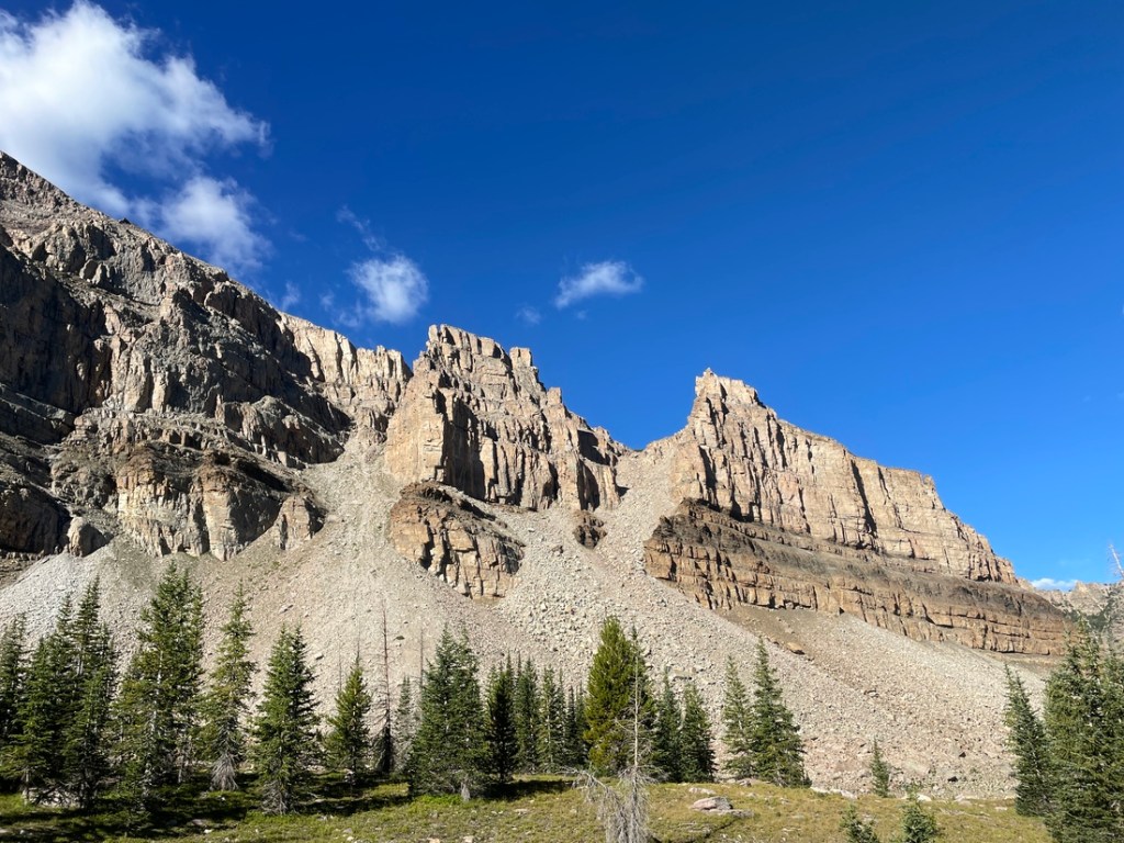
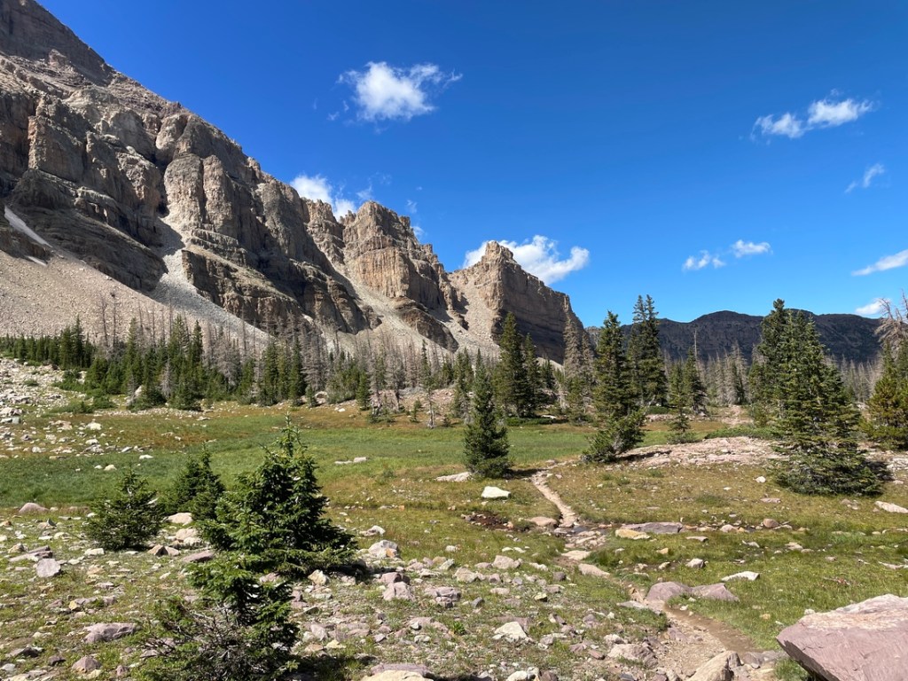
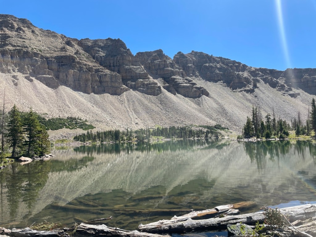
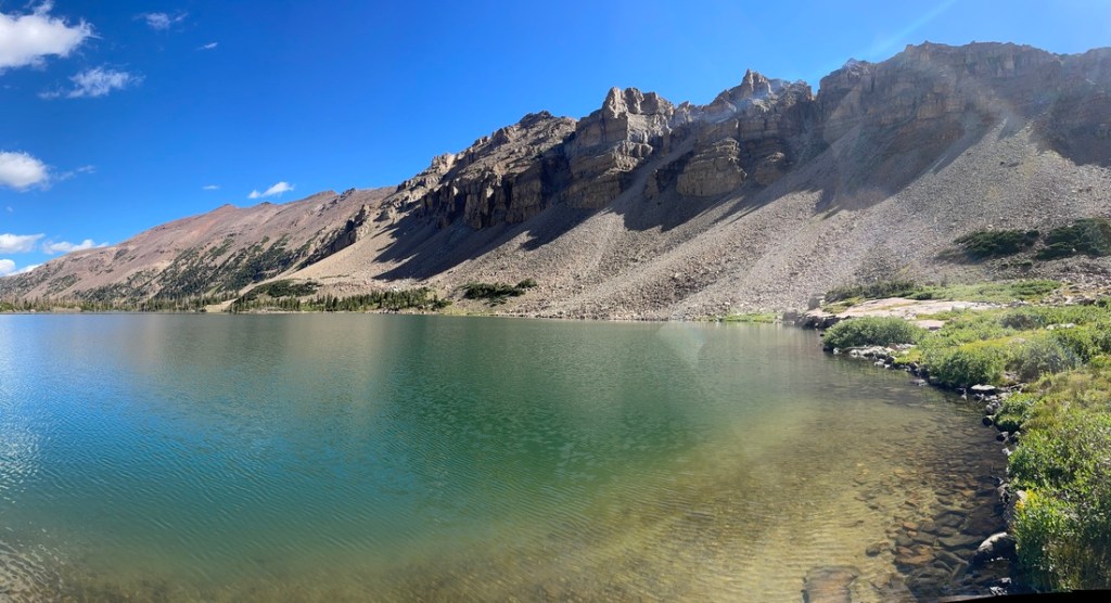
The Uinta Mountains on both sides of the trail are gorgeous. Up toward and at the lake they start to surround the hiker with Amethyst Lake itself being what looks to be an old glacial basin. Ostler Peak rises over 12,700 feet above one side of the lake, while a ridge of mountains circles around much of the rest of the lake.
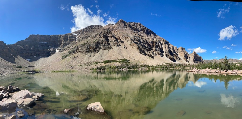
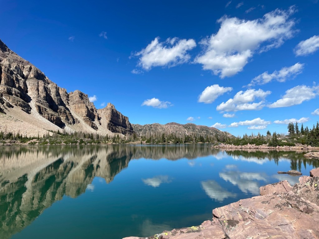
Once I arrived at Amethyst Lake, which sits at almost 11,000 feet in the Uintas, I was stunned by the beauty. The sky was blue with just a few clouds, making for amazing photos. The water was so clear I couldn’t tell if I was looking into 2 or 20 feet of water. Brook trout were abundant and I caught loads of them using simple spinners.
I hiked all the way around the lake before heading back down the trail to Christmas Meadows.
After hiking over 14 miles I got back to Christmas Meadows, where I had parked earlier in the morning. It was time to reflect on a tiring, but amazing, hike and then to drive back to Sandy, Utah.

Leave a comment